When you are buying property for the first time, you usually look at your Survey Number.
You find the property on the village map.
You check its boundaries.
Everything appears to match.
And you think:
“Looks good.”
But what if you stopped looking too soon?
This is where Clear Khata takes an additional step.
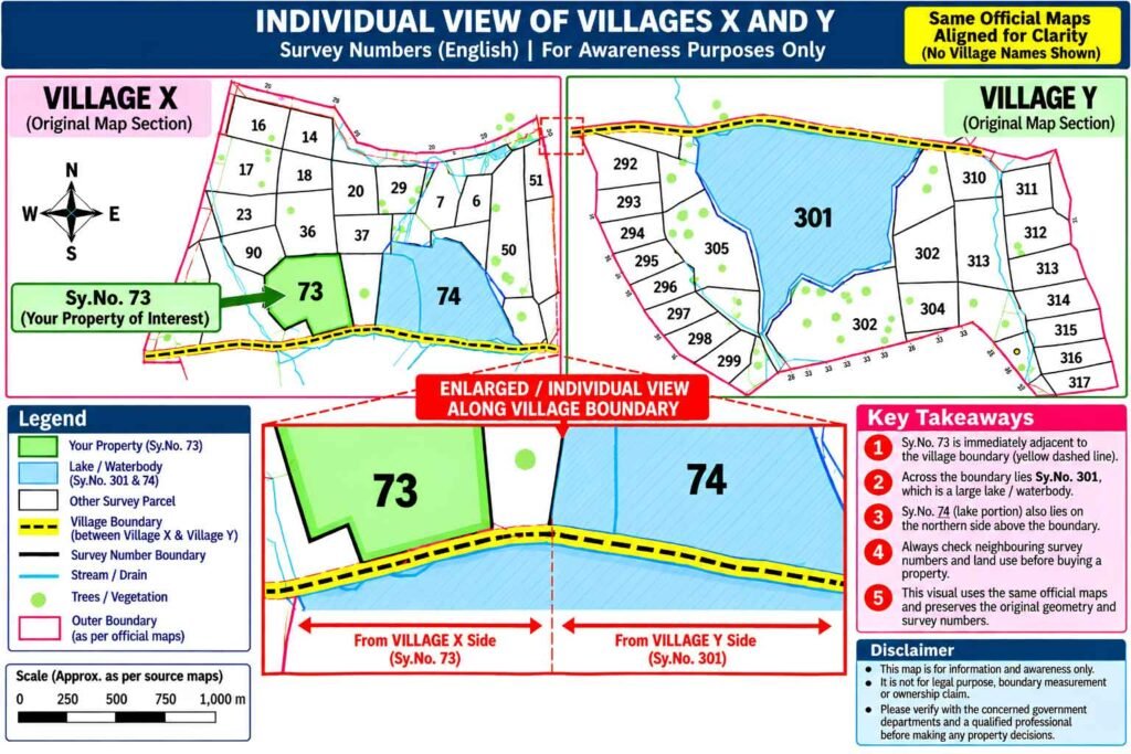
Take a look at Sy.No. 73 of Village X in our example.
When we look at the individual cadastral survey map of Village X, Sy.No. 73 appears to be an ordinary parcel. There is no obvious lake or waterbody shown along its boundary in that individual view.
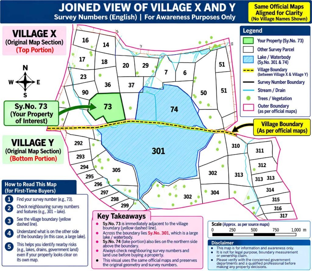
Now look at the combined view of the villages.
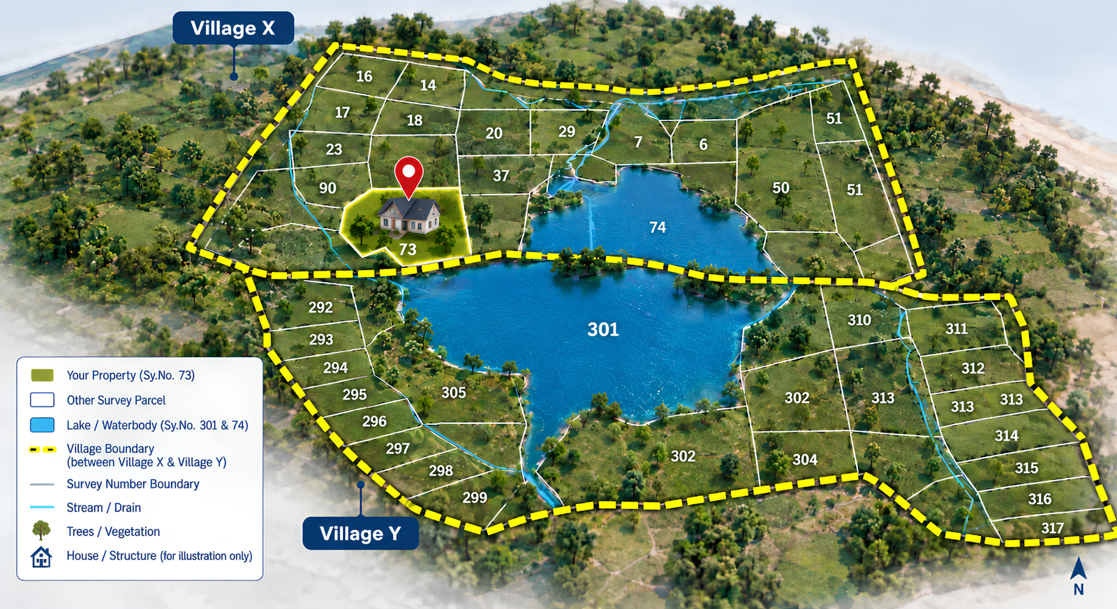
We bring the adjoining Village Y cadastral survey map into the picture and create a joined view.
Suddenly, the surrounding land becomes much easier to understand.
Across the village boundary, the map shows the large waterbody identified as Sy.No. 301.
The property didn’t change.
Our view of the property did.
And that is the idea behind the Clear Khata 2-Map approach.
We don’t just ask:
“What does my village map show?”
We also ask:
“What does the adjoining village map show?”
This additional layer can help identify things that may not be obvious when a property is viewed in isolation — including neighbouring survey numbers, waterbodies and other mapped land features.
And once something important appears in the wider cadastral picture, that is when deeper due diligence begins — including verification of the relevant official records and any applicable regulatory requirements.
We are not saying that a neighbouring lake automatically makes Sy.No. 73 affected by a buffer or restriction.
We are saying something much simpler:
If the lake is there in the adjoining cadastral picture, it deserves to be investigated before you make a property decision.
That is the difference between simply checking a property and trying to understand the land around it.
Your property may have four boundaries.
Your due diligence shouldn’t.**
At Clear Khata, we believe property verification should not end where your village boundary ends.
JARGON BREAKDOWN — IN SIMPLE ENGLISH
Cadastral Survey Map
A detailed land map showing individual survey parcels, their boundaries and other mapped land features.
Survey Number (Sy.No.)
The identification number given to a particular parcel of land in the survey/revenue records which is broken down in to multiple sites/plots.
Village Boundary
The boundary separating the land records/map area of one village from another.
Buffer / Buffer Zone
A regulated or restricted area around certain features where specific rules may apply. The existence of a nearby waterbody does not by itself establish that a particular buffer applies to a property. The applicable rule and current official records need to be checked.
The accompanying maps are presented for awareness and educational purposes. They do not by themselves establish title, ownership, exact legal boundaries, buffer applicability or development eligibility. Relevant matters should be verified against current official records and applicable regulations.


Add comment